

Services
From first assessment to long-term support
We help public agencies get more out of ArcGIS: a clear plan, a well-built system, automated workflows, and someone to call when something breaks.
Core services

ArcGIS Enterprise & cloud architecture
Design, installation, upgrades, and migrations for ArcGIS Enterprise and ArcGIS Online, on-premises or in Microsoft Azure and AWS, with GPU virtual desktops for ArcGIS Pro, Entra ID sign-in, SSL and domain cutovers, and security hardening.

Custom web GIS
Web GIS built on the ArcGIS Maps SDK for JavaScript when off-the-shelf apps aren’t enough: secure sign-in and role-based access, custom tools and widgets, migrations from the retired 3.x API, and integrations with permitting, work-order, and other business systems.

Python automation
ArcPy and ArcGIS API for Python tools that replace manual, repetitive work: scheduled data updates, county parcel refreshes, map production, QC checks, and reporting, each with a user guide.

Enterprise geodatabases
Expert design and administration of SQL Server, PostgreSQL, and Oracle geodatabases: data modeling, capacity and upgrade planning, performance tuning, traditional and branch versioning, security, and scheduled maintenance automated with Python.

Needs assessments & roadmaps
We review your people, data, software, and workflows, then deliver a prioritized GIS roadmap with realistic costs and timelines. No cost for local governments.

On-call support & training
A senior GIS team on retainer for troubleshooting, upgrades, and security updates, plus hands-on training for analysts, editors, and administrators using your own data.

Experience Builder apps & dashboards
Experience Builder apps with custom widgets, plus ArcGIS Dashboards and Hub sites that give staff, leadership, and the public a clear, current view of operations, assets, and performance.

Stormwater & utility GIS
Storm, sewer, water, and recycled-water data models, network cleanup, and leak analytics, with readiness reviews and migration roadmaps from Geometric Network to Trace Network and Utility Network.

QA/QC with Data Reviewer
Expert ArcGIS Data Reviewer batch jobs, attribute rules, and topology that find and fix errors before they reach your users, scheduled to run automatically and documented so your staff can maintain them.

Field data collection
Field Maps, Survey123, and QuickCapture forms with required fields, pick lists, and offline maps, plus survey-grade GNSS for control and as-built locations. Drone and aerial imagery through our teaming partner.

Data development & map production
As-built conversion, georeferencing, and digitizing at scale, from decades-old drawings to standards-based GIS, plus automated production of plat books, wall maps, and atlases, and ArcGIS Pro migrations of legacy tools.

Federal facilities GIS
SDSFIE data models, Navy and USMC installation data, and survey-grade control networks, delivered with automated QC and FGDC metadata for federal facilities and real-property programs.
Application development
Apps for staff, field crews, and residents

Dashboards & web apps
Dashboards and Experience Builder apps your staff open every day, with custom widgets or full ArcGIS Maps SDK apps when configuration isn’t enough.

Mobile apps
Field Maps, Survey123, and QuickCapture set up for each crew’s job, with offline maps and edits that sync back when crews reconnect.
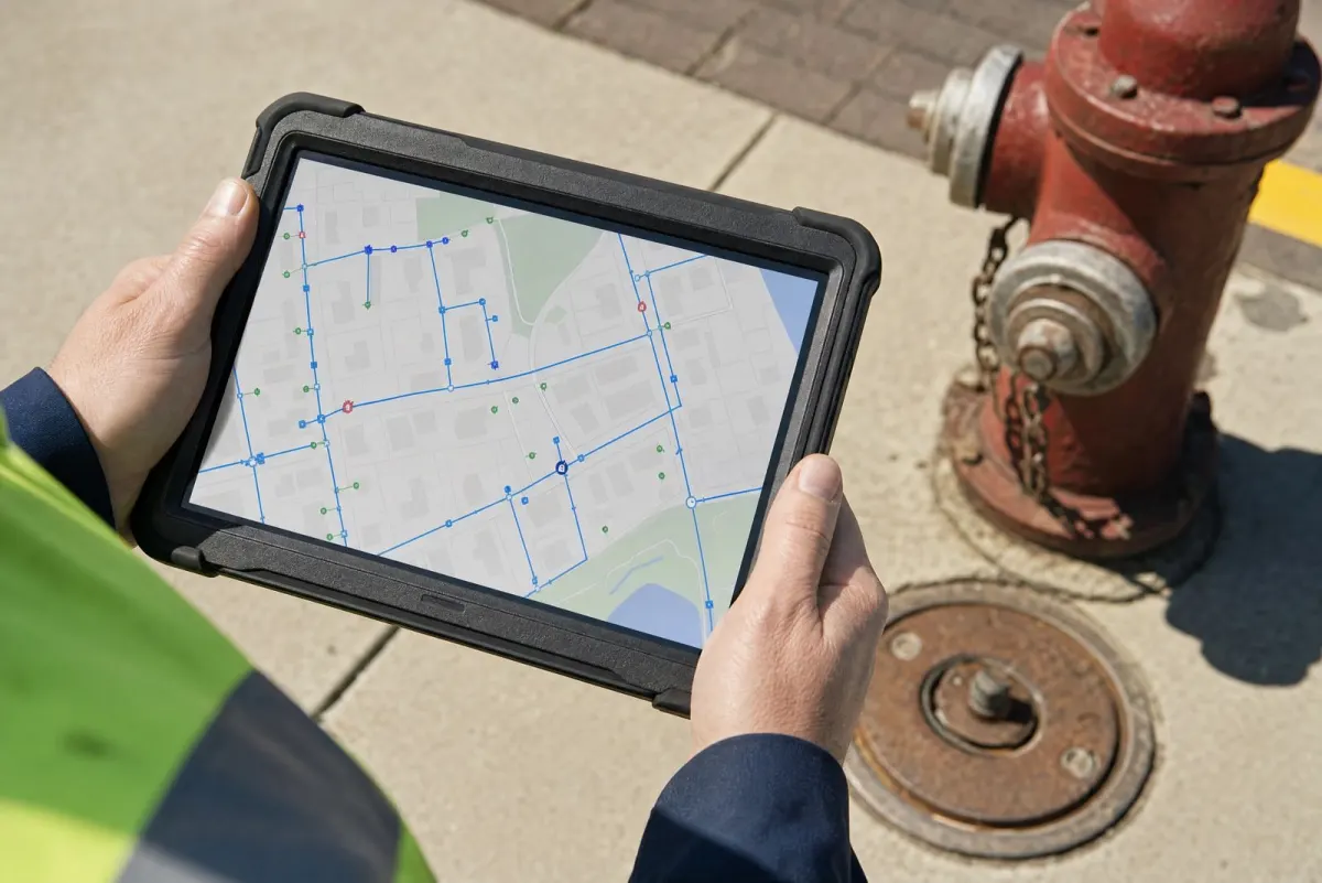
Field inspections
Smart forms with pick lists and required fields, so inspections and inventories land clean in your geodatabase, with no re-keying back at the office.

Public maps & sites
ArcGIS Hub sites, story maps, and public viewers that answer residents’ questions.

ArcGIS Enterprise Health Check
Know what’s running, what’s at risk, and what to fix first
A fixed-scope review of your ArcGIS Enterprise or ArcGIS Online deployment, with a prioritized report your IT and GIS staff can act on.
- Versions, security patches, and SSL certificates
- Map services, instances, and response times
- Geodatabase maintenance, backups, and locks
- Sharing and security: public editing, owner data, accounts
- Integrations with asset management, permitting, and other business systems
- Licensing, credits, and unused content
- Cloud sizing and cost on Azure or AWS
Integrations
Connected to the systems you already run
We connect ArcGIS to the asset, permitting, code enforcement, and content systems you already run, so parcels, addresses, and assets stay in sync. Every connection runs on a schedule, with quality checks and least-privilege service accounts.
- Assets & work orders: GIS-based asset inventories and work orders in Trimble’s Cityworks, OpenGov’s Cartegraph, CentralSquare EAM (formerly Lucity), or any other EAM or CMMS, including upgrades and versioned editing
- Permitting, licensing & code enforcement: parcel and address integration with Accela, Tyler EnerGov, MyGovernmentOnline, GoGov, or any other community development platform, with code cases mapped to ArcGIS Enterprise layers through dedicated service accounts
- Content & document management: SharePoint, Laserfiche, OnBase, or other document repositories linked to the parcels and assets they describe
- Imagery & GIS services: ArcGIS Online and Living Atlas layers, GIS REST feeds, Nearmap and EagleView aerial imagery, and image services, refreshed on a schedule
Each connection uses the methods the vendor supports: feature services, database views, REST APIs, or scheduled Python jobs. Every one comes with documentation, monitoring, and a rollback plan, so your staff know what moves, when, and why.

Specialized expertise
Local government
Parcels and cadastral data, addressing, redistricting, stormwater and utility networks, and field inspection workflows.
Federal & defense
Installation geospatial programs, SDSFIE data modeling, real property reconciliation, GNSS control surveys, and maritime charting data.
Map publishing
Plat-book and map production automation, parcel and base-layer databases, and subscription web GIS platforms.
How we work
Four steps, one senior team
01
Listen
We start by understanding how your staff actually work day to day.
Interviews · survey
02
Plan
A right-sized plan that fits your budget, staff, and existing Esri investment.
Roadmap · costs
03
Build
Hands-on implementation, documented so your team can own it.
Deployment · docs
04
Support
We stay on call after go-live, so problems get fixed fast.
On call · training
Not sure where to start?
A needs assessment gives you a clear picture of where your GIS program stands and what to do next.